Once every three months , we receive a Discovery Travel book in the mail and as Little man and I were flipping through, we came across a mine car ride. After doing some research, we found that the mine car ride is located in West Virginia. Since we are in Tennessee and it isn’t that far to drive, we decided to take a short trip in October to check out the coal mine. We left on a Wednesday afternoon around 2:00 pm for a seven hour drive, this includes stopping to get gas and eat. We arrived at our hotel in Beckley, West Virginia around 9:30pm central time, however West Virginia is in the Eastern Time Zone. During this trip, we found out that there is so much more to West Virginia than we ever imagined: the scenery, the outdoor activities, the coal mine history, and the mountains!
DAY 1
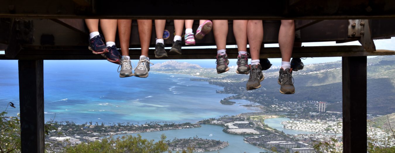
The Exhibition Coal Mine is located on Harper Road in Beckley, West Virginia. It is open April 1st – November 1st with the operating hours of 10am-6pm. Seen here is the museum, store, and where you purchase tickets. The admission price is $20/adult and $12/child ages 4-17. The price includes everything: the museums, the houses, and the coal mine ride.This is the Superintendent’s house, he is the boss of the coal mine and the coal camp town. The coal camp town is its own little village with a school, church, store, and all the miner’s houses. The Superintendent also owned the store within the village, so when he paid the workers for a ton of coal, they then spent that money in the store for goods. Therefore, he was getting all that money right back into his pocket.The coal mine tour takes you 1500 feet beneath the hillside of New River Park. The tour takes about 35 minutes and is very educational. As you ride in a “man car” into the mine, you stop along the way to learn about the progression of mining throughout the years. Seen here is a one ton trailer of coal, the miner’s were paid twenty cents per ton. Therefore, the miner’s did not make a lot of money. In addition to the low pay, they had to pay the Superintendent $4 a month to rent a house for their family, if they were single, they could rent a one room house for $2 a month.All of the tour guides are retired miners. This is Roger, our tour guide, and he was a coal miner for 28 years. Here, he is demonstrating how the beams overhead are installed to help prevent the mine from caving in.There are so many interesting facts that we learned while on the tour, one fact is that the school only taught up to the 8th grade. After the 8th grade, the children went to work instead of school. Also, at the age of 10, the boys could start mining with their fathers, however they did not get paid until the age of 16, so they essentially worked six years for free. If a miner was killed on the job, the wife and children had five days to move out of the house unless the wife married another miner within that time frame. Seen in the picture above is a view of the tracks inside the coal mine.Little Man sitting in the driver’s seat of the “man car” that we rode in.This is a replica of what the first coal camp town may have looked like.At each house or area, there is a tour guide that explains the history and answers any questions that you may have. During our tour of the replicated first coal camp, the tour guide let little man write with a quill pen, which is what they would have used during that time frame.After doing some research, I found that the best place to eat in Beckley, WV is at Tamarack. When we pulled up, this is not what we were expecting, however it is an awesome place to visit. It is a large arts and crafts facility that sells West Virginia crafted products. Tamarack opened in 1996 and was the first place to sell statewide collections of handmade arts and crafts in the United States.“A Taste of West Virginia” food court is located inside Tamarack. Seen here, is the Fired Green Tomato Sandwich, which is what West Virginia is known for. Tamarack is open daily from 8am-8pm, with the exception of the winter months of January and February, then the hours are 10am-7pm.Great Bend Tunnel is also known as Big Bend Tunnel and is where the famous John Henry defeated the steam-powered steel-driving machine that cost him his life in the 1870s. No one really knows if the legend of John Henry is true. Whether the story is true isn’t really what matters, it is more of what the story represents and that is “machines cannot replace the heart or craftmanship that people put into their work.”This is inside the famous Big Bend Tunnel. Construction started in February 1870 at both ends of the tunnel. About 800 men were employed during construction which was completed in September 1872. The original tunnel was built out of timber, however, for safety it was changed over to a brick lined arch in 1893. This tunnel was closed in 1974 after being in use for 102 years. There is a newer tunnel parallel to Big Bend that the trains use today to pass under Big Bend Mountain.This is the view from the Alderson Memorial Pedestrian Bridge in the small town of Alderson.A View from the train tracks located in Alderson, West Virginia. The tracks are used by Amtrak, as well as, the trains that haul coal.Seen here is one of the trains hauling 100 cars filled with coal. The train came by about ten minutes after I took the picture of the tracks.We ended our day at Babcock State Park, this picture was taken as we took the scenic route to our cabin.
DAY 2
We rented this cabin for a night at Babcock State Park. It is located along the New River Gorge in Fayette County, West Virginia.The cabin’s have electricity, but no TV or Cell Phone service. The fire is a wood burning fire that you get up in the middle of the night to put wood in or it goes out. This is the fire Chris built and we sat around talking, laughing, and making memories.The cabin had a small kitchen, a dining table, a full size bed, and bunk beds. This is me and the kids on the top bunk.Mom and Dad stopped for a photo on the path down to our cabin.This kids loved running and playing in the leaves. There is also a swinging bridge that crosses over the creek.Babcock State Park is 4,127 acres of beautiful scenery.The famous Glade Creek Grist Mill is the most photographed tourist site in the state of West Virginia and I can see why. Chris took this photo and it looks like a painting! It was built in 1976, is fully operable, and is a recreation of the original ground grain mill known as Cooper’s Mill.Boley Lake was built in 1965 within Babcock State Park. It is an 18-acre lake with a maximum depth of 25 feet. In the summer, you can rent paddle boats, cast a reel and fish from the banks, or walk the trail that goes all the way around the lake.Cathedral Cafe is located in Fayetteville, West Virginia and where we stopped to grab lunch. It is open Sunday-Thursday 7:30am-4pm and Friday and Saturday 7:30am-9pm.There are so many menu options, including Gluten Free Sandwiches and Salads. The Coffee is delicious as well.Cathedral Cafe was built inside an old church which adds to the coffee shop vibe. Upstairs there is a small consignment shop and a great photo opportunity to look down into the restaurant.A delicious cup of hot chocolate.After lunch, we drove into Charleston for our tour of the Governor’s mansion and the state capital building. The Governor’s mansion is located on the grounds of the state capital. The house was built in 1925 and the Governor is required to live there during his term in office.The first room of the tour was the drawing room or entertaining room. Adjacent to this room is the sitting room, where the Governor holds some of his meetings. We were only allowed to tour the first level of the house because the Governor and his family currently live on the second and third levels.The Formal Dining Room is still used for formal dinners at the mansion. The table is over 150 years old, and the seat cushions were had stitched from artists within the state of West Virginia. The mansion has 30 rooms and a total of 21,000 square feet.The State Capital Building in Charleston, West Virginia took eight years to built with construction being completed in June 1932. The total cost was just under $10 million.The Capital Building is 292 feet tall making it the tallest building in West Virginia and 4.5 feet taller than the capital building in Washington D.C. The chandelier that hangs from a 54 foot brass chain in the center of the rotunda weighs 4,000 pounds and uses 96 light-bulbs. Once every four years, the Chandelier is lowered to the floor for cleaning, which takes three days.Located on the second floor of the rotunda, is the Robert C Byrd statue that stands 10 feet tall. The late Senator Robert C. Byrd was the longest serving member of the U.S. Congress.Lil Man pushing in the pocket doors with our tour guide. There are nine different types of marble that make up 75% of the buildings interior construction. The exterior is made up of Indiana buff limestone. The building is 530,000 square feet with 333 rooms.There are two wings on the second floor, one leads to the House of Representatives and the other leads to the Senate Chamber. The rooms look identical. The Legislative desks are made from black walnut and are original from 1932. The Chandelier that hangs in the center is made up of 10,000 pieces of crystal.On the main floor, there is a photo opportunity at the Governor’s podium.The Coal Miner’s Statue stands outside the capital building and was erected in 2003 for $150,000. The miner is seven feet 6 inches tall and stands on a 5 foot tall base. The plaques around the base depict different periods of mining and the technologies that were used. By placing the plaques there, this helped with the dispute over the miner representing a modern-day miner rather than the early days of mining.The West Virginia State Museum and Culture Center is located on the grounds with the Capital Building and the Governor’s Mansion. The operating hours are Tuesday – Saturday 9am-5pm and the admission is free. I highly recommend stopping by this museum, it gives a lot of detail and explanation on the history of West Virginia.This is a replica of an old soda shop inside the museum. It starts from the beginning before West Virginia became a state through the current time period. West Virginia became a state during the civil war, by seceding from the Confederate State known as Virginia. West Virginia did not choose the Union side because of slavery, it was because of taxes. The Confederates taxed land based on how much land you have, well in most southern states if you have 1,000 acres you can farm most of it, this is not the case in West Virginia. There are so many mountains that if you own 1,000 acres, you might be able to farm 100 acres of it. Therefore, the Union taxed the land based on how much of it you can actually use instead of how much you owned, so by changing to the Union side this helped out the people of West Virginia when it came to paying land taxes. This made West Virginia the 35th state of the United States.
DAY 3
The Capital Market is located in Charleston inside an old transfer dock at the end of Smith Street. There is outdoor and indoor shopping. The market is open daily with the exception of major holidays, Monday-Saturday 9am-6pm and Sunday Noon-5pmThe outdoor portion of the market had fresh vegetables and a variety of pumpkins.Capital Street is the historic, quaint street located in downtown Charleston. It has many diverse shops and restaurants. We walked around on a Saturday morning, however, many shops do not open until 11am.After we walked around in downtown Charleston, we decided to drive back to Fayetteville, also known as the Coolest Small Town in West Virginia.We chose to eat at the Secret Sandwich Society, it was recommended by someone in Charleston. From our observation, there is a really long wait time, the food is just ok, and they claim to be Gluten Free but there is a lot of cross contamination. Of the entire trip, this is the one place that I would not recommend stopping.After lunch, we stopped at Canyon Rim Visitors Center located in Fayetteville. This is a must stop to pick up the map for directions of the 12 mile drive all the way around the bridge.The New River Gorge Bridge spans 3,030 feet with an arch of 1,700 feet long. The bridge is 876 feet above the water and is the fourth longest spanning bridge in the world. Construction on the bridge was complete in 1977, the bridge cut the vehicle travel time from one side of the gorge to the other from 45 minutes to about 45 seconds.Every Year, on the third Saturday in October the bridge is shut down for B.A.S.E jumpers and rappelling off the bridge. This has been an annual one-day event since 1980.Along the New River Gorge 12 mile scenic drive, there are plenty of photo opportunities. Most of the drive is a one-way, one-lane road with a lot of places to pull-off.Fayette Station Road is the one hundred year old road that vehicles took before the New River Gorge Bridge was built. While at the visitors center, grab a free CD that tells the history of the area while you drive along, it also explains the stops along the way. It took us about 90 minutes to drive the entire road.One of the stops along Fayette Station Road.This was one of the last stops along the 12 mile Fayette Station Road.On the way back to Charleston, we stopped at Hawk’s Nest State Park in Ansted. This is the main lodge and I put it on here because to get to the infamous Lover’s Leap, you have to walk along the right side of the lodge. We went after hours and had to stop people and ask because there are no signs telling you where to go.There is an aerial tram that will take you down to the bottom of the River Gorge for $4/person or you can take the path to the right to walk to Lover’s Leap. This trail has about 120 steps and is pretty steep.A view from the Lover’s Leap trail. We got there just in time to catch the train.Lover’s Leap is an overlook at Hawk’s Nest State Park and is the location of many romantic inspired suicide stories of young lovers that cannot be together due to family and cultural differences.About a mile outside the town of Gauley Bridge is Cathedral Falls. It is located just off US Rt. 60, which is a scenic byway that travels to from Fayetteville to Charleston.Cathedral Falls is a 60 foot water fall that cascades down the narrow canyon land. I would suggest getting out and taking the very short hike for a better view, even though you can see it from the road.A view of the Pratt-style iron truss railroad bridge in Gauley Bridge, West Virginia.
DAY 4
On our last day in West Virginia, we decided to do the Hatfield and McCoy trail as we made our way back to Tennessee. Our first stop was in the very small town of Sarah Ann, West Virginia, this is where the Hatfield Family Cemetery is located.The hike up to the Hatfield Cemetery is very steep, but seeing Captain Anderson “Devil Anse” Hatfield’s statue is worth the hike. A life sized statue that was modeled from photographs and imported from Italy marks his grave site. “Devil Anse” died in 1921, however the statue was not placed on his grave until 1926.A view looking down onto “Devil Anse” Hatfield’s grave.Elias and Troy Hatfield were in the saloon business and were killed in a shootout on October 17, 1911 over liquor distribution. In this photo, if you look closely at “Devil Anse” grave, you can see all 13 of his children’s names listed under his statue. Troy and Elias were his sons.The town of Matewan is an absolute must stop while doing the Hatfield and McCoy trail. Before it became a coal town, it was known as Tug Valley and the Hatfield’s lived on the West Virginia side and the McCoy’s lived on the Kentucky side. Matewan is very close to where the McCoy boys were tied to the Paw Paw tree by the Hatfields.West Virginia is known for it’s off-road trails. This is what we seen when we walked out of the Mexican restaurant that we ate lunch at.A street sign in the historic district of Matewan.The Matewan Museum is located on the main street and tells the history of the Hatfield’s and McCoy’s, as well as, the Matewan Massacre. The admission is free, however, they accept donations. The Matewan Massacre took place because the coal miners joined a union. The battle was between Police Chief Sid Hatfield and Mayor Testerman, which ended in the death of the Mayor, two miners, and seven agents.This flood wall was built all the way around the town of Matewan with five gates that close when the river water rises. Seen on the wall is the date of 1977, that is the date that a massive flood wiped out the town of Matewan. Soon after that flood, the wall was built. Since 1977, the gates have been closed about nine times due to the river water rising.From Matewan, we drove to the town of Williamson, which is the second town that makes up Tug Valley from the Hatfield and McCoy days. Williamson is known for the Coal House that was built in 1933 and is the location of the Tug Valley Chamber of Commerce. The house is made from 65 tons of coal from the nearby Winifrede Seam. While inside the Coal House, we were able to meet and talk with the great-great grandson of “Preacher Anse” Hatfield who was the deciding factor in the stolen pig case. We asked about the history and if the Hatfield’s and McCoy’s still feud, he said “No, everyone gets along and have even married each other.” It was amazing to hear the history from a decedent of one of the Hatfield’s.Located just outside of the coal house is a statue of Chief Logan from the Mingo Tribe. It is rumored that he is known for “Logan’s Lament” which is a speech he delivered after Dunmore’s War in 1774.After exploring in Williamson, West Virginia, we drove into Pikeville Kentucky, where the McCoy’s lived. The grave sites of Sarah and Randolph McCoy are located on a hillside in Dils Cemetery. Randolph was the patriarch of the McCoy clan, with his wife Sarah by his side.The grave of the famous Roseanna McCoy is located right beside her parents in Dils Cemetery. Roseanna fell in love with Johnse Hatfield during the feud. This caused even more issues between the two families. In 1881 , Roseanna gave birth to Sarah Elizabeth McCoy Hatefield, unfortunately, the baby died the same day.Sam McCoy is one of the sons of Randall and Sarah McCoy, his grave is also located in Dils Cemetery. To get to the grave of Sam and his wife Martha you have to follow path off to the right that makes a loop around the cemetery. There are also two members of the Hatfield’s buried in this cemetery, however you have to walk up a steep hill that is separate from the loop.After ending our Hatfield-McCoy Trail, we made our way to Stanville, Kentucky and drove past this huge Lincoln located on Highway U.S. 23. It is known as the “second largest seated Lincoln statue in the world” standing 19 feet high with the base.A view of the morning fog in the mountains of West Virginia.
West Virginia is a beautiful state with more to do than you could ever imagine. I recommend diving deep into the history and the experiences that it has to offer, you never know what you may find.
Charleston, West Virginia and the surrounding area